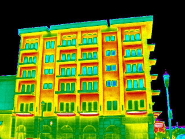
Utilizing dedicated cameras, drones can achieve infrared thermal photography from angles and positions otherwise impossible. Images can include both buildings and equipment in industrial areas and in residential areas. A thermography can reveal performance problems occurred during the design phase, construction phase or during maintenance activities, and can help prevent unwanted accidents.


Prev
Next
Applicability for infrared thermal photography:
- Facade thermal insulation problems;
- Existing thermal bridges in the building envelope;
- Air leak / leaks;
- Risk areas for condensate and mold;
- Joinery non-performance on heat transfer;
- Problems with the roof, insulation and their deficient areas;
- Distribution of non-performance air conditioning;
- Route hidden / buried sewage distribution network or heating;
- Electrical problems that is going to generate short circuits;
- Loss of fluid / gases from refrigerating plants;
- Problems with installation or mechanical processes;
- Loss of steam / warmth;
- Pipes with insulation damage inducing losses on the route;
* AERIAL PHOTOGRAPHY:
Orthophotomaps and Photogrammetry
3D Terrain Models
Oblique and Panoramic Images
Electrical Network Monitoring
Multispectral Photos
Industrial and Residential Buildings
Wind Farms and Photovoltaic Parks
Agriculture Monitoring
Protected Natural Areas
Telecommunication and GSM Pillars